The Solo Cross-Country Backup Plan: Building Layered Navigation Before You Leave the Pattern
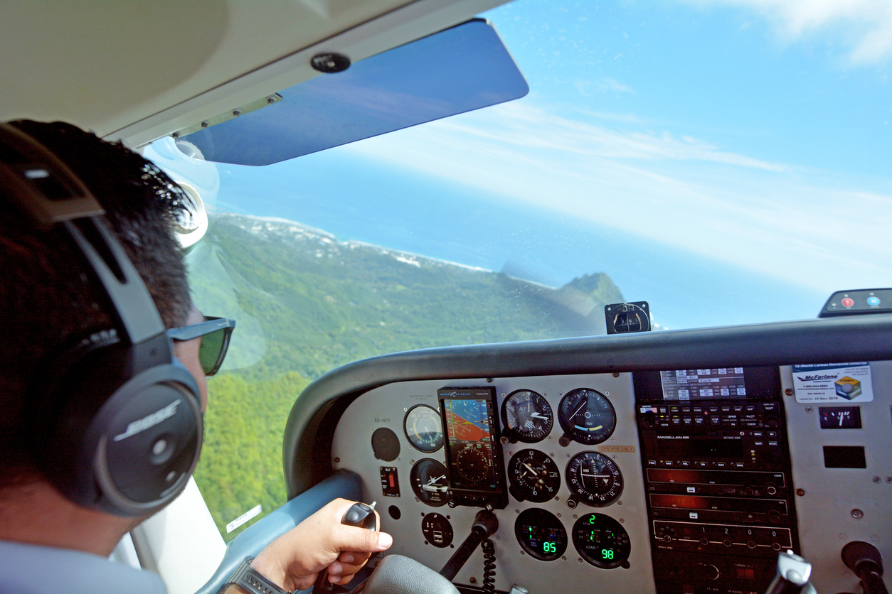
Most student pilots plan their first solo cross-country around one question: "Which route is shortest?" A better question is: "What do I do when my primary navigation source stops working?" Practicing a second method before you need it, such as this plain-language walkthrough of tuning, identifying, and tracking a VOR radial, turns a stressful surprise into a routine cross-check. This guide shows how to build a layered navigation plan that holds up when a tablet freezes, a signal drops, or the weather changes your route.
Key Takeaways
- A solo cross-country plan should name a primary navigation method and at least two independent backups.
- Pilotage and dead reckoning remain the foundation; electronic tools confirm them, not replace them.
- Radio navigation gives you a check that does not depend on the same system as your GPS or tablet.
- The best time to rehearse a backup is on the ground, with a written plan, before the engine starts.
Why It Matters
Navigation errors rarely begin as dramatic events. They start as small mismatches: a heading that drifts a few degrees, a checkpoint that arrives two minutes late, a screen that shows something your eyes do not. A pilot with only one method has nothing to compare against, so the mismatch goes unnoticed until it becomes a problem.
Student pilots face this on the first solo cross-country, often the first time no instructor is beside them to say, "Does that look right?" The FAA practical test standards expect you to demonstrate pilotage, dead reckoning, and the use of navigation systems, and to show good judgment when something goes wrong. A layered plan is how you build that judgment into the flight before takeoff.
Key Insight: Redundancy is not distrust of your equipment. It is a habit that lets you spot a problem early because you have a second source of truth to compare against.
Start With One Primary Method and Name Your Backups
A layered navigation plan assigns one primary method and at least two independent backups for every leg of the flight. "Independent" matters: a GPS app on a tablet and a GPS unit powered through the same battery can fail together, so they count as one layer.
For a typical daytime solo cross-country, a reasonable stack looks like this:
- Primary: Visual pilotage, checked against a current sectional chart.
- Backup one: Dead reckoning with a planned heading, time, and fuel burn for each leg.
- Backup two: Electronic or radio navigation, used as a cross-check rather than the lead.
Write this stack on your navigation log. Seeing it on paper makes you more likely to use it in the air, and your instructor can review it and spot gaps before you ever leave the ground.
Why the order matters
The lead method should be the one you can still perform when everything electrical goes quiet. That is why pilotage and dead reckoning sit at the top for most student flights. Electronics are excellent at confirming where you are, and they are most useful when you already have a mental picture to compare them against.
Pilotage and Dead Reckoning Still Do the Quiet Work
Pilotage is navigation by visual reference to landmarks, and dead reckoning is navigation by computed heading, airspeed, and elapsed time. Together they give you a position estimate that needs no outside signal.
Good checkpoints are the heart of pilotage. Choose features that are hard to confuse: a highway interchange, a large lake with a distinctive shoreline, a rail line crossing a river. Avoid checkpoints that look like their neighbors, such as small rural roads or a single water tower in an area full of them.
Dead reckoning works when your numbers are honest. Use wind-corrected headings from your winds aloft forecast, note your actual ground speed at the first checkpoint, and update your estimates for every leg after that. If your time at a checkpoint is off by more than a minute or two, treat it as information, not an inconvenience.
Common checkpoint mistakes
- Picking checkpoints too close together, which leaves no room to correct course.
- Picking checkpoints too far apart, which lets drift grow unnoticed.
- Relying on a single landmark without a confirming feature nearby.
- Skipping time notes because "the tablet will tell me."
Radio Navigation as an Independent Check
Ground-based radio navigation gives you a position check that does not depend on satellites or on your tablet. A VOR, or VHF omnidirectional range, transmits radials you can tune and track with a basic cockpit receiver, which makes it a natural second opinion alongside GPS.
For a student pilot, the goal is not to fly an entire route on VOR. The goal is to be able to tune a station, confirm the identifier, center the needle, and read which radial you are on. That skill lets you answer "Where am I?" in under a minute using a source completely separate from your primary one.
Here is how the common tools compare for a student cross-country:
Pro Tip: Tune a nearby VOR on every cross-country, even when you do not plan to use it. Identifying the station and noting your radial at two checkpoints takes seconds and builds a habit that pays off on instrument training later.
Build the Plan on the Ground
The strongest navigation habits are built during flight planning, not in the air. Use a repeatable sequence so nothing gets skipped when you feel rushed.
- Draw your course line and mark checkpoints every 10 to 15 nautical miles where the terrain allows.
- Pull the current winds aloft and compute headings, ground speeds, and times for each leg.
- Identify at least one VOR or other radio aid near each leg and note its frequency and identifier.
- Pick two diversion airports along the route and write down their frequencies, runways, and headings from your course line.
- Set personal minimums for visibility, ceiling, and fuel reserve, and write them at the top of the log.
- Brief your instructor on the stack: primary method, two backups, and your trigger for diverting.
That last point deserves emphasis. A "trigger" is a specific condition that sends you to your diversion plan, such as "If I cannot confirm my position by the second checkpoint, I turn toward the nearest airport." Deciding this on the ground removes the pressure of deciding it under stress.
A Concrete Example: A 70-Nautical-Mile Solo Leg
Consider a student preparing for a solo flight of roughly 70 nautical miles between two towered airports, with a lake and an interstate highway along the route.
The student picks four checkpoints: a highway interchange at 15 nautical miles, the southern tip of the lake at 30, a rail junction at 48, and a small reservoir at 60. For each leg they compute a heading and time using the winds aloft, and they write the numbers next to each checkpoint.
Beside the route sits a VOR about 12 nautical miles off the course line. The student writes its frequency and identifier on the log and notes the radial expected at the lake checkpoint. In flight, the lake arrives about 90 seconds late, which suggests a stronger headwind than forecast. The student tunes the VOR, confirms the identifier, and finds the needle centered a few degrees off the expected radial. Two independent sources agree, so the student updates the estimates, adjusts the fuel plan, and continues with confidence.
Nothing dramatic happened, and that is the point. The layers turned a small mismatch into a calm correction. A student with only one method would have had a guess where this student had a confirmed position.
Actionable Takeaways
- Write a navigation stack on every log: one primary method and two independent backups.
- Choose checkpoints that are distinct and spaced to catch drift early.
- Record actual times and ground speeds at the first checkpoint and update the rest of your estimates.
- Tune and identify a VOR on every cross-country, even as a rehearsal.
- Write a diversion trigger and two diversion airports before you start the engine.
- Review the plan with your instructor, and treat their questions as free practice for the checkride.
Conclusion
Solo cross-country flying rewards pilots who plan for the ordinary problems: a late checkpoint, a stronger wind, a screen that behaves strangely. Layered navigation costs a few extra minutes on the ground and gives you clear choices in the air. Build the habit now, and it will carry through instrument training and into every cockpit that follows.
FAQ
What is layered navigation for a student pilot?
Layered navigation means using more than one independent method to confirm your position and course. A typical stack combines pilotage, dead reckoning, and an electronic or radio aid. If one method fails or disagrees with the others, you notice quickly and can act.
How many checkpoints should I plan on a cross-country flight?
A checkpoint every 10 to 15 nautical miles works well for most student flights, as long as the terrain offers distinct features. Closer spacing helps in areas with few landmarks. Spacing that is too wide lets drift build before you can catch it.
Is a VOR still useful if I have GPS?
Yes, because a VOR works independently of satellites and gives you a second source of position information. Many instructors and examiners expect students to show basic VOR skills during training and checkrides. It also serves as a backup if your GPS or tablet stops working.
When should I divert on a solo cross-country?
Divert when a pre-set trigger is met, such as being unable to confirm your position by a planned checkpoint, or weather dropping below your personal minimums. Deciding the trigger on the ground makes the choice easier in flight. Diverting early is a sign of good judgment, not a failure.
What should a navigation log include?
A useful navigation log lists each checkpoint, planned heading, ground speed, time, and fuel for every leg. It should also include radio frequencies, a nearby VOR if available, and two diversion airports. Add your personal minimums at the top so they are the first thing you see.